|
|
<< Pulse para mostrar la Tabla de Contenidos >> CARTOGRAPHY IMPORTER |


|
|
|
<< Pulse para mostrar la Tabla de Contenidos >> CARTOGRAPHY IMPORTER |
|
|
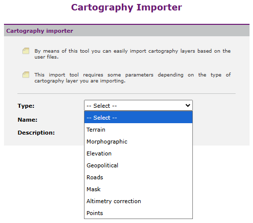
Xirio allows a user to import new cartography layers, which will be available only for that user. There is an access to the cartography importer in the User cartography dialog. Like other cartography layers, these user layers are characterized by a type, a name and a description (optional).
When the layer type is selected, Xirio asks for the file to import the layer from. This file is required to be previously uploaded to the platform through the user files manager. Depending on the layer type, it can be also necessary to specify the fields containing each one of the data to use. Once the process is successfully completed, the imported layer will be available in the cartography selection dialog like any other layer in Xirio. |