|
|
<< Pulse para mostrar la Tabla de Contenidos >> LOCATIONS CATALOG |


|
|
|
<< Pulse para mostrar la Tabla de Contenidos >> LOCATIONS CATALOG |
|
|
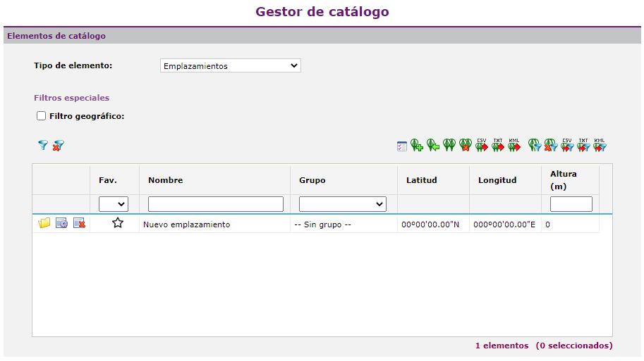
Xirio locations represent geographical coordinates in which different transmitters or receivers are located. Creating sites can be done with the icon create new catalog element For sites filtration the following controls are available: •Geographical filter: This filter allows the user to select an area for the location searchs, for this it is necessary to define the four corners of the square or rectangle.
When the locations have been filtered the following actions are available: • • • • • • • • • • • • •
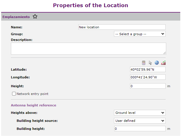
The dialog associated with the locations is shown below:
In the location dialog the user can configure the following parameters: •Name or Code. •Description. •Latitude and Longitude (Geographical WGS84). The user can enter the coordinates manually, using the button "Select a point on the viewer", the coordinate calculator •Height. Location tower height. Heights in Xirio can be defined with respect to: oRoof level, equivalent to the height of the radiating system mast above the building oGround level, equivalent height from the street ground. If the “Terrain level” option is selected, it will not be necessary to configure the other two options. If you select "Roof level" you can: oDefine a building height oForce it to read the height of the DEM layer being used. |