|
|
<< Pulse para mostrar la Tabla de Contenidos >> CARTOGRAPHY ACTIONS |


|
|
|
<< Pulse para mostrar la Tabla de Contenidos >> CARTOGRAPHY ACTIONS |
|
|
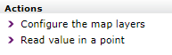
The following options can be accessed from the actions panel of a study's cartography folder:
•Configure the map layers. From this option the user directly accesses the configuration of the mapping of the study. •Read value in a point. From this option the user can click on the viewer to obtain the altimetry level, elevation and the type of morphography of the layers selected in the study. When there are several layers of the same type selected, they are combined to choose the most appropriate one for each pixel based on the resolution.
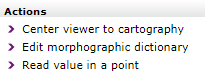
In addition, from each of the different cartography layers you can access the following options:
•Center viewer to cartography. From this option the user can adjust the position and zoom of the viewer to the borders of the selected cartography layer. •Edit morphographic dictionary. This option is only available when the study has a morphography dictionary defined. From this option the user can edit the study dictionary. •Show morphographic dictionary. This option is only available when the study does not have a specific morphography dictionary. From this option the user can visualize the layer's default morphographic dictionary. •Read value in a point. From this option the user can click on the viewer to obtain the data of the selected cartography layer. |