|
|
<< Pulse para mostrar la Tabla de Contenidos >> ENDS SECTION |


|
|
|
<< Pulse para mostrar la Tabla de Contenidos >> ENDS SECTION |
|
|
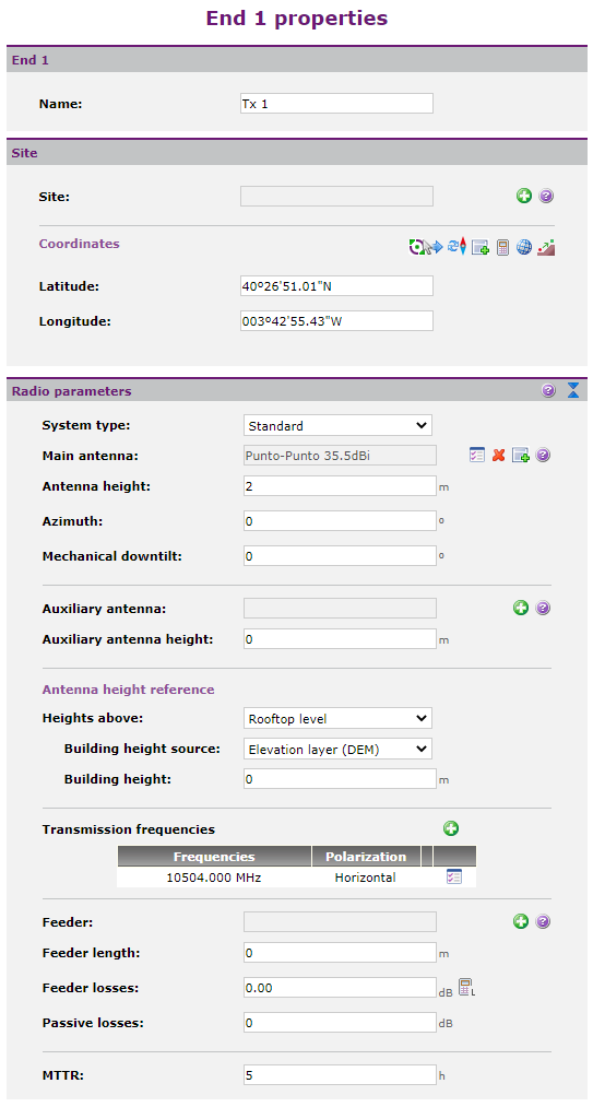
This section allows to configure the initial and final end of the radio link, as well as all jumps in passive repeaters that exist between them. By default there is only End 1 and End 2, but the user can add between them one or more passive repeaters clicking ENDS PROPERTIES The following image shows the page appearance of the end properties:
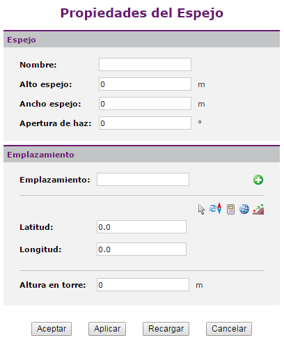
The user can consult or modify the following parameters for each end: •End Name. It is the location name or code. . •Location. It is the site (station) where the end is located. •Latitude and Longitude (Geographical WGS84). They are the real coordinates in which the end is located and specifically its main antenna. They may or may not be the location coordinates. The user can enter the coordinates manually, using the button "Select a point on the viewer", the coordinate calculator •Main Antenna. •Height. De la antena principal, tiene que tener coherencia con las alturas construida de la base de la torre seleccionada. •Antenna orientation and tilt. •Auxiliary antenna. This antenna can work as an anti-reflective mechanism, provide diversity or anti-XPD protection. •Auxiliary antenna height. Tiene que tener coherencia con las alturas construida de la base de la torre seleccionada. •Transmission frequencies list. It includes polarizations.. •Feeder, length and losses. •Auxiliary losses. •MTTR (Mean Time To Repair). PROPERTIES OF THE MIRRORS The following image shows the page appearance of the mirror properties:
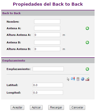
The user can consult or modify the following parameters for each mirror: •Name. It allows the user to identify the mirror. If the user uses a site to locate the mirror, it will be the same as the location one, and so it can not be edited. •Mirror width and height. •Mirror beamwidth. •Location. It is the site (station) where the mirror is located. •Latitude and Longitude (Geographical WGS84). They are the real coordinates in which the mirror is located. They may or may not be the location coordinates. The user can enter the coordinates manually, using the button "Select a point on the viewer", the coordinate calculator •Tower height. PROPERTIES OF THE BACK TO BACK The following image shows the page appearance of the back to back properties:
The user can consult or modify the following parameters for each back to back: •Name. It allows the user to identify the back to back. If the user uses a site to locate the back to back, it will be the same as the location one, and so it can not be edited. •Antenna A. •Antenna A height. •Antenna B. •Antenna B height. •Location. It is the site (station) where the back to back is located. •Latitude and Longitude (Geographical WGS84). They are the real coordinates in which the back to back is located. They may or may not be the location coordinates. The user can enter the coordinates manually, using the button "Select a point on the viewer", the coordinate calculator |