|
|
<< Pulse para mostrar la Tabla de Contenidos >> MAIN WINDOW |


|
|
|
<< Pulse para mostrar la Tabla de Contenidos >> MAIN WINDOW |
|
|
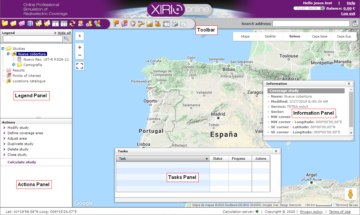
For getting the firt overview of Xirio platform, before starting to work, we briefly describe here the user interface.
•Viewer. It is the main element of the browser window. The various elements of the studies (transmitters, receivers, places of interest, etc.) and graphic results of radio coverage are represented on this viewer. The user can place transmitters and receivers by clicking directly on the display, or define areas of calculation and multi-coverage studies, or move items by selecting them. •Toolbar. It is placed at the top of the window.There, the user can find the functionality related to management of studies, results, visualization users, templates, etc.; as well as having direct access to basic cartography features, such as the terrain profiling, calculation of distances and azimuths or query of the terrain height at one location. In the following link you can find more detailed description of buttons on the toolbar. •Window caption. It shows all the elements that have been opened during the current session, arranged in a tree structure. This tree is composed of studies, results, points of interest, transmitters, receivers, compute methods, etc. •Actions window. It shows the actions that can be performed, associated with the currently selected element (transmitter, study, results, etc.) which is currently selected in the window caption. •Information window. This is a popup window that provides information for the selected item in the window caption. The user can open and close this window by clicking •Window of tasks. This window displays information on progress of the running calculations. It is closed by default and shown when the user starts a calculation. As with the information window, this one can be opened by clicking •Search for addresses. It allows searching for addresses or geographical terms, placing them on display. It uses the search engine that implements the well-known Google Maps viewer. |